
Monday, May 31, 2010
San Juan River Eastern Utah Ruins Pt.1
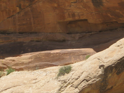
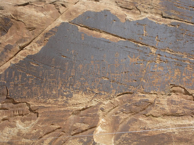
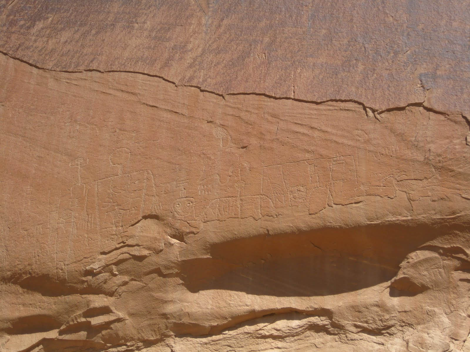
Wandered along the San Juan River in Eastern Utah near Comb Ridge today and enjoyed the Ruins and Rock Art..............


Rock Art (Anasazi and Fremont) Pt.2
These are all found on the San Juan River near Comb Ridge.
The sun would not cooperate with me so these pictures are not the best.
You have to see them in person to get the full effect. This panel is truly amazing.


The sun would not cooperate with me so these pictures are not the best.
You have to see them in person to get the full effect. This panel is truly amazing.


The Last letter home dropkick murphys
Hello there my dearest love
Today I write to you about our sons
The boys start school today
They're the spitting image of you in every way
Hey son it's Dad
I hope this letter finds you well out of harm's way
We saw the news today it frightened your Mom
Now all she does is pray
[Chorus:]
If I lead will you follow?
Will you follow if I lead?
Hey Melissa it's me don't be afraid
I'm in good hands I'm gonna be home soon
It's time to watch the children grow up
I wanna be more than a voice on the phone
Thanks Ma I got your package today
I love "The Fields Of Athenry"
I swear I want 'em to play that song on the pipes
At my funeral when I die
[Chorus]
I stand alone in the distance
And the foreground slowly moves
[Chorus]
"We regret to inform you that on January 28th Sgt. Andrew
Farrar died while serving his country in the Al-Anbar province
of Iraq words cannot convey our sorrow"
[Chorus]
When there's nothing on the horizon
You've got nothing left to prove
If I lead will you follow?
Sunday, May 30, 2010


Something to think about

Laws: We know what they are, and what they are worth! They are spider webs for the rich and mighty, steel chains for the poor and weak, fishing nets in the hands of the government.
Pierre-Joseph Proudhon


Desert Days My Life as a Field Archaeologist Fred Wendorf

Dr. Fred Wendorf came of age and began his career during a formative period in American archaeology. But after leaving his permanent mark on the development of archaeology in the American Southwest and the United States, he essentially founded the study of the prehistoric eastern Sahara, beginning with the Aswan Dam Project in the Nile River Valley. His life, nearly ended by a bullet on a WWII battlefield in Italy, has included an archaeological research career spanning six decades and an unsurpassed record of seminal contributions. His recently published book, Desert Days: My Life as a Field Archaeologist, is a record not only of a life, but of an epoch in the history of archaeology on two continents. This is history he not just witnessed, but to a significant degree he created it through his innovative approaches and endless energy, which should serve as an inspiration to subsequent generations of archaeologists.


Saturday, May 29, 2010
Friday, May 28, 2010
Muley Point Utah

MULEY POINT
Elevation: 6,270 ft.
Ecological niche: juniper-pinyon woodlands
Ownership: U.S. Department of the Interior, Bureau of Land Management, National Recreation Area
Location: Cedar Mesa, north of Monument Valley and Mexican Hat in southeastern Utah
Valley of the Gods

Many people have seen Monument Valley, the vast, iconic desert on the Arizona-Utah border that’s gorgeously interrupted by colossal sandstone monoliths, like bulky ships sailing an ocean of sand. Most often they’ve seen it in the context of a Hollywood shoot-’em-up with cowboys like John Wayne twirling six-shooters and dodging arrows. But few people know that 40 miles up the road there is another monumental valley—a geological Mini-Me known as the Valley of the Gods. A quarter the size of its famed neighbor, it has dozens of equally spectacular sandstone sculptures and spires, but on a smaller scale. What they lack in size, they make up for in brilliant color and variety. And best of all, you’re unlikely to see a single tourist bus here.

Dusted with fine red dirt and punctuated with silver-green brush, the valley lies at the base of a 1,200-foot bluff called Cedar Mesa that was formed when a sea invaded from the northwest 250 million years ago. The area’s jagged towers, gravelly washes, and tortured sandstone formations line Valley of the Gods Road, a 17-mile dirt route that links Highways 163 and 261, forming a scenic loop. Each bend in the road reveals a surprise, a slightly different shade of red or a new rock contortion, many of which are described in Navajo legend as ancient warriors frozen in time. There are places to pull over and hike, have a picnic, or, if you’re so inclined, do some bouldering. But don’t expect restrooms or a snack bar.

Subscribe to:
Comments (Atom)